Showing posts with label environment. Show all posts

13 August 2026

Beyond Politics: A Radical Curriculum for Rebuilding Our World

I asked AI about education curriculum that might enable leaders to innovate new adaptations for survival on Earth as if people were actually free to build their own physical habitat on Earth de novo rather than exist in the historical evolution infrastrucute box

AI- You are describing something much closer to macro-engineering, industrial ecology, and regenerative civilizations design than traditional politics.

You are asking a fundamental design question: If we started from first principles with the biology of a hominid and the carrying capacity of Earth, how do we engineer the physical and social infrastructure to support 10 billion people sustainably? Traditional politics takes our messy, historical infrastructure as a given; you want to treat the planet as a blank canvas for optimal survival and thriving.

To study or work on this kind of “planetary retrofitting,” you need fields that merge physical science, infrastructure engineering, and systems thinking.

The Fields That Match Your Vision

  • Industrial Ecology: This is often called the “science of sustainability.” It treats the entire global industrial system as an ecosystem. It calculates exactly how materials, energy, and waste must flow so that human infrastructure can scale up without destroying the biosphere.
  • Ecological Engineering / Regenerative Design: This field focuses on designing human systems that integrate seamlessly with natural ecosystems. Instead of building concrete boxes that fight nature, it designs infrastructure that mimics natural cycles to provide clean water, food, and energy at a planetary scale.
  • Civil and Environmental Engineering (Earth Systems focus): This moves away from politics entirely and focuses on the physical reality. It asks how we design mega-scale water grids, smart cities, and transit networks that can physically sustain billions of people safely.
  • Systems Dynamics / Earth System Science: Pioneered by places like the MIT Systems Dynamics Group, this field uses computer models to simulate how human populations, resources, pollution, and capital interact over centuries. It is the tool used to test what “genius society” structures would actually survive long-term.

Why “Politics” Fails Your Goal (and Where It Fits Later)

In your vision, politics is secondary to design. A standard politics major won’t teach you how to design a planetary grid or calculate carbon cycles.

However, your idea connects to politics in one specific way: Resource Allocation and Coercion. Even if you design the perfect, most harmonious physical infrastructure to support 10 billion people, you still have to figure out how to get 10 billion messy, opinionated hominids to actually live in it, maintain it, and not break the rules. That is where “Social Design” or “Institutional Economics” comes in—creating the incentives that keep the physical engine running.

To see which engineering or systems field matches you best, let me know:

  • Do you want to focus on the physical design of the infrastructure (energy grids, circular water systems, green cities)?
  • Do you want to focus on the computer modeling side (simulating global resources, food supply, and population data on a massive scale)?

Gary- I was kind of impressed by I don’t know if it was the Riyadh uh vision for some long city you know narrow out in the middle of the desert where millions could live in.  I’d like to actually be able to especially in this era of increasing global warming, imagine some kind of way to design a physical infrastructure energy grid and all the rest of that and  resource use and the actual structure whether it need to be an artificial mountain range or whatever that that people could live in and and thrive and and be happy.

AI-

The project you are thinking of is The Line, a massive 170-kilometer-long linear city proposed by Saudi Arabia as part of their NEOM megaproject. While it captured the world’s imagination with renderings of a mirrored sci-fi city slicing through the desert, it also serves as a perfect cautionary tale for your goal. Engineering reality and the actual laws of physics have caught up to it: the Saudi government has officially halted major construction and drastically scaled it back, shifting focus toward standard infrastructure like ports.

If you want to move past flashy 3D renderings and actually design physical systems, energy grids, and geo-structures that can adapt 10 billion people to a warming planet, you are looking for an intersection of Arcology, Geo-engineering, and Macro-Infrastructure Design.

Core Disciplines for Your Vision

  • Arcology (Architecture + Ecology): Coined by architect Paolo Soleri, this field focuses on designing hyper-dense, self-contained megastructures. Instead of sprawling cities that destroy nature, an arcology packs living spaces, farming, and waste recycling into a singular, highly efficient structure—much like the “artificial mountain range” or “long city” you envisioned.
  • Earth Systems Engineering and Management (ESEM): This discipline treats the entire planet’s infrastructure as an active thermodynamic system. It calculates how massive energy grids, artificial wind-breaks, and planetary scale micro-climates can be engineered to counteract global warming localized to human habitats.
  • Industrial Ecology & Circular Infrastructure: This field maps out how a massive population can reuse 100% of its resources. It designs the “metabolism” of a city, ensuring that the waste heat from an energy grid perfectly powers a vertical farm, which in turn feeds the population and purifies the water.

How You Design for 10 Billion People (The Mechanics)

If you were to approach retrofitting the earth from first principles, you would focus on three core layers of structural design:

  1. Passive Thermal and Structural Design: To thrive in 50°C global warming scenarios, you design mega-structures that use the earth itself or artificial geometry for cooling. An artificial mountain range, for instance, uses the orographic effect—physically forcing air upward to cool it, create condensation, and generate localized rainfall and wind currents.
  2. Decentralized Smart Super-Grids: Instead of fragile, centralized power lines, a planetary adaptation grid uses interconnected, high-voltage direct current (HVDC) lines that move massive solar, wind, and geothermal power across continents dynamically, shifting electricity to where the population demands it in real time.
  3. Closed-Loop Hydrology: At a scale of 10 billion, water cannot be wasted. Infrastructure must be designed for Water Sensitive Urban Design (WSUD), where massive multi-tier water recycling networks filter greywater and treated wastewater to sustain urban green barriers and hyper-dense vertical farms without ever touching depleting natural aquifers.

To pursue this type of planetary retrofitting, standard urban planning or politics won’t give you the tools. You need to look into graduate programs or research institutes dedicated to Systems Engineering, Macro-Engineering, or Environmental Science & Engineering blocks.

If you want to keep exploring this concept, let me know:

  • Do you want to look at how real-world arcologies (like Arcosanti or Biosphere 2) attempted to build closed-loop systems?
  • Are you interested in the physics of how mega-structures can passively control their own climate and weather?
  • Would you like to see which university labs are currently modeling planetary-scale resource grids?

Gary- Planetary scale resource grids

AI-University research into planetary-scale resource grids operates at the bleeding edge of engineering, data science, and physics. Rather than studying political policy, these labs write the physical and mathematical equations to model a world where 10 billion people are supported by interconnected, global infrastructure. [1, 2, 3, 4]

Several major university research labs, academic consortia, and foundational frameworks are currently mapping out these planetary systems. [1]


🌐 Global Supergrids & Macro-Energy Systems

These researchers ask: How do we build a singular electrical network across continents to balance the planet’s energy? High-Voltage Direct Current (HVDC) lines lose only about 1.6% of their energy per 1,000 km, making a global loop technically feasible. [5, 6]

  • Harvard China Project (Harvard University): Harvard researchers have extensively modeled the Global Energy Interconnection (GEI) concept. Their work simulates how a 180,000-kilometer intercontinental supergrid could link every continent except Antarctica. By connecting 100+ countries, it leverages the Earth’s rotation—moving solar power from continents experiencing daytime to continents experiencing peak evening demand in real time. [7, 8, 9]
  • The SuperGrid Institute (Europe): A collaborative academic-industrial research hub involving major European universities, specializing in large-scale EMT (Electromagnetic Transient) simulation. They model the physical realities of multi-vendor, trans-continental direct-current networks, ensuring the grid doesn’t experience catastrophic cascading failures across thousands of miles. [10]
  • Stanford Doerr School of Sustainability: Led by researchers like Aditi Sheshadri, Stanford recently broke decades of gridlock in climate and atmospheric modeling. By repurposing NASA’s AI foundation models and linking gravity wave data to global atmospheric equations, they allow engineers to accurately predict exactly how global wind currents and weather patterns will interact with planetary renewable grids. [4]

🗺️ Planetary-Scale Human-Earth Atlases & Models

Before you can build a physical grid for 10 billion people, you must build a digital twin of the Earth to map human resource consumption against planetary boundaries. [11]

  • The SESAME Human-Earth Atlas: Developed by an international research consortium, the Surface Earth System Analysis and Modeling Environment (SESAME) provides a standardized spatial grid that tracks hundreds of human and non-human variables. It allows researchers to use machine learning to model how human resource networks (food, mining, transit) interact directly with biological systems down to fractions of a degree. [12]
  • MIT Joint Program on the Science and Policy of Global Change: Famous for its Integrated Global System Modeling (IGSM) framework. This tool simulates the global economy, human population growth, resource grids, and the Earth’s ecosystems as a singular, feedback-loop system to test what “genius society” infrastructures can actually survive long-term. [1, 13, 14, 15]
  • The Earth System Grid Federation (ESGF): A massive multi-university grid computing project using distributed supercomputers to manage petabytes of planetary data. It provides the sheer computational infrastructure required to model how localized urbanization affects planetary-scale weather extremes. [2, 16, 17]

⚠️ The Design Hurdle: The “Variety Deficit”

University research into these mega-grids has identified a primary systemic danger called the Law of Requisite Variety. [3]

Scale-free global networks are highly resilient to random localized failures, but they are exceptionally vulnerable to targeted systemic shocks. Academic researchers warn that planetary-scale orders suffer from a profound “variety deficit”—meaning that no centralized human or AI governing body possesses the biological or computational bandwidth to manage the staggering number of chaotic variables generated by billions of humans interacting with a shifting environment. Therefore, the current research trend is moving away from centralized control and toward autonomous, self-healing grid nodes. [3]

If you want to dive deeper into the technical mechanics, let me know if we should explore:

  • The mathematics of HVDC power lines and how they prevent energy loss over transcontinental distances.
  • How AI foundation models are being used to predict planetary energy supply.
  • The structure of closed-loop industrial ecology models.

[1] https://www.sciencedirect.com

[2] https://ieeexplore.ieee.org

[3] https://medium.com

[4] https://sustainability.stanford.edu

[5] https://en.wikipedia.org

[6] https://medium.com

[7] https://chinaproject.harvard.edu

[8] https://www.nature.com

[9] https://pmc.ncbi.nlm.nih.gov

[10] https://www.supergrid-institute.com

[11] https://www.science.org

[12] https://pmc.ncbi.nlm.nih.gov

[13] https://www.facebook.com

[14] https://www.ercim.eu

[15] https://gisgeography.com

[16] https://eesm.science.energy.gov

[17] https://eesm.science.energy.gov


23 July 2026

Building a Half Billion Dollar Plus Shipyard at Wrangell?


I asked A.I. about the context of building a half to three quarter billion dollar shipyard at Wrangell.

Gary- Do you think there is a market sufficient to invest in building a three quarter of a billion dollar ship repair facility at wrangell alaska?

A.I.– A $605 to $726 million shipyard in Wrangell faces major economic hurdles. A standalone commercial market alone is likely insufficient to justify this massive price tag, so the project’s viability depends on public-private partnerships, securing federal defense contracts, and capitalizing on the Coast Guard’s expanding Arctic operations. [1, 2, 3]

Key Market Variables

  • Sky-High Costs: Full build-out estimates range from $605 million to $726 million. The project requires aggressive phasing to be digestible. [1]
  • Target Customers: The proposed 500-foot shipyard relies heavily on securing contracts with the U.S. government, U.S. Navy, U.S. Coast Guard, and research vessels. Private commercial vessels (e.g., state ferries) alone cannot carry this level of capitalization. [1, 2, 3]
  • Partner Backing: The City and Borough of Wrangell has established a memorandum of understanding (MOU) with Seattle-based JAG Marine Group and Miami-based Pearlson & Pearlson to navigate port feasibility and secure state and federal funding. [1, 2, 3]
  • Geopolitical Drivers: Proponents are pitching the facility to federal officials as vital to national security and Arctic patrol maintenance. [1, 2]

Actionable Information

  • Review Project Proposals: Read the initial assessments on the Wrangell Economic Development page.
  • Current Feasibility: Keep an eye on ongoing 30% design phase deliverables that will dictate long-term funding requirements. [1]

Gary- Can a population of 2000 people afford that sort of thing?

A.I. No. A local population of 2,100 people cannot afford a project of this scale through local taxes or municipal debt.

The project relies entirely on external funding, with the local community acting as a host rather than a financial backer.

The Funding Reality

  • Zero Local Funding: Wrangell’s municipal budget cannot support a $700 million project. Local residents will not pay for the construction through property or sales taxes.
  • Federal Defense Dollars: Proponents are targeting federal funding. This includes the Department of Defense, Department of Transportation (MARAD), and federal infrastructure grants.
  • Private Capital: Private partners like JAG Marine Group are expected to bring external investment to cover commercial operational costs.
  • State Support: The State of Alaska may provide economic development grants, as the facility would boost the regional maritime economy.

Local Risks and Impacts

  • Infrastructure Strain: A massive shipyard brings hundreds of temporary construction workers and permanent contractors. A small town must upgrade its housing, utilities, and medical services to handle the influx.
  • Economic Boom: If funded externally, the facility would create high-paying year-round jobs. This would diversify a local economy currently reliant on seafood and tourism.

To help evaluate if this project makes sense for the region, tell me what concerns you most:

  • The environmental impact on the local waters?
  • The potential boom-and-bust cycle for housing and schools?
  • How it compares to competing shipyards in Seattle or Ketchikan?

Let me know what area you would like to explore next.

Gary- All three

A.I.-Building a massive $605M to $726M shipyard in a town of 2,100 people creates intense friction between economic opportunity and small-town stability. [1]

1. Environmental Impact on Local Waters

Heavy marine industrialization introduces severe localized environmental risks to Wrangell’s pristine waters. [1]

  • Contaminants and Runoff: Large-scale ship repair involves hull blasting and painting. This releases toxic anti-fouling copper or tin paints, volatile organic compounds (VOCs), and microplastics directly adjacent to marine habitats. [1, 2, 3]
  • Industrial Noise & Dredging: Operating a 38,000-ton lift and servicing 500-foot vessels generates significant underwater noise and light pollution. This can disrupt local marine mammals and migratory salmon corridors. [1, 2, 3, 4]
  • The “Brownfield” Advantage: On the positive side, Wrangell plans to place this facility at the 6-Mile Mill property. Because this is a former timber mill site, it is already an altered industrial footprint rather than untouched, pristine coastline. [1, 2, 3]

2. The Threat of a Boom-and-Bust Cycle

Bringing an estimated 150 permanent shipyard jobs—plus hundreds of transient construction workers—into a tiny community triggers a classic infrastructure shock. [, 2]

  • The Housing Crisis: Wrangell already suffers from a severe housing shortage. Local officials note it is a “chicken and egg” problem; developers won’t build without guaranteed buyers, yet the workforce cannot arrive without housing. The borough is proactively designing 60-unit complexes at the old hospital site and expanding sub-divisions to get ahead of the crush. [1]
  • Utility & School Strain: The influx will heavily tax local water systems, electricity grids, and medical clinics. While a population boost could save local schools from declining enrollment, a sudden exit if a major federal contract expires would leave the town holding massive debt for over-expanded infrastructure. [1, 2]

3. Competition with Ketchikan and Seattle

Wrangell is entering a highly competitive and protective Pacific Northwest maritime market.

  • The Ketchikan Rivalry/Alliance: Nearby Ketchikan already features a world-class shipyard owned by the state (AIDEA) and operated by the exact same company partnering with Wrangell: JAG Marine Group. JAG recently secured a $99.6M federal NOAA contract for Ketchikan. While JAG claims a Wrangell facility would “complement” Ketchikan by expanding overall Alaskan capacity, the two sites will inevitably compete for a limited pool of skilled labor and state resources. [1, 2]
  • The Seattle Monopolies: Major vessel operators and the Alaska Marine Highway (state ferries) traditionally send their largest ships to massive, deeply entrenched shipyards in Seattle, Washington or Portland, Oregon. Wrangell’s advantage is geography—it is thousands of miles closer to the opening Arctic defense theater. However, convincing unions and private operators to move logistical hubs up to an isolated island community is a steep hill to climb. [1, 2, 3]

Would you like to look closer at how the town plans to build housing for these workers, or examine the specific types of Coast Guard ships they are trying to attract? [1, 2, 3]

Gary– What are alternative businesses that might attract as much employment to wrangell

To match or exceed the job footprint of a major shipyard (roughly 150 permanent trades jobs), Wrangell has a few alternative pathways. Because the town wants year-round, high-wage, “blue-collar” industrial employment rather than seasonal or minimum-wage work, alternative solutions focus on leveraging Wrangell’s low utility costs, deepwater port, and existing natural assets. [1, 2, 3]

1. Expanded Marine Service & Haul-Out Center

Instead of building a $700M mega-shipyard for 500-foot federal vessels, Wrangell could expand its existing Wrangell Marine Service Center. [1, 2]

  • The Concept: Focus on private commercial fishing fleets, tugboats, yachts, and regional barges.
  • Employment Potential: Expanding the current haul-out yard and adding support trades (welding, machining, fiberglass repair, electrical) could support 50 to 100 year-round jobs.
  • The Advantage: Much lower infrastructure costs, less environmental risk, and direct support for the local fishing fleet. [1, 2, 3]

2. High-Tech Green Data Centers

Wrangell has some of the lowest electrical rates in Alaska due to regional hydropower. Local officials have already discussed sharing the 6-Mile Mill site with data center infrastructure. [1, 2]

  • The Concept: Partner with companies like Greensparc to build localized data centers cooled naturally by the Alaskan climate.
  • Employment Potential: While the data centers themselves require few permanent staff, combining them with a renewable energy generation hub or tech manufacturing could bring 30 to 50 tech and maintenance jobs.
  • The Advantage: Clean industry with a tiny physical and environmental footprint compared to heavy industrial ship repair. [1]

3. Healthcare Hub Expansion (SEARHC)

According to the Wrangell Economic Conditions Report, healthcare has already quietly overtaken government and seafood as Wrangell’s largest economic cornerstone. [1]

  • The Concept: Formally establish Wrangell as a specialized, regional healthcare hub for Southeast Alaska, anchored by the Southeast Alaska Regional Health Consortium (SEARHC). [1, 2]
  • Employment Potential: Healthcare already accounts for 171+ jobs and $15.2M in annual wages. Expanding long-term care facilities, specialized therapy, or regional medical training programs could easily add 50 to 70 high-paying, year-round positions. [1]
  • The Advantage: Highly stable, high-wage jobs that naturally attract families and do not suffer from industrial “boom-and-bust” cycles. [1]

4. Advanced Seafood Processing & Mariculture

The traditional seafood sector is struggling with weak salmon returns, but ocean farming presents a major pivot. [1]

  • The Concept: Scale up regional kelp and oyster mariculture alongside an automated, year-round value-added seafood processing plant (producing ready-to-eat products rather than just freezing raw fish). [1]
  • Employment Potential: Transitioning from seasonal canning to year-round specialized processing and mariculture logistics could sustain 80 to 120 jobs.
  • The Advantage: Strengthens Wrangell’s cultural identity and supports local fishermen while building an eco-friendly export market. [1]

5. Tourism and Waterfront Expansion

Wrangell is currently entering its strongest tourism period in two decades. [1]

  • The Concept: The borough is actively trying to expand its waterfront by adding a second cruise dock to capture more boutique and mid-sized cruise ships. []
  • Employment Potential: Tourism easily generates over 100 jobs, but they are heavily skewed toward the summer months. [1]
  • The Advantage: Low capital costs for the town, but it fails to meet the borough’s stated goal of creating year-round, trades-based blue-collar employment. [1]

If you were advising the town, would you prioritize expanding the stable healthcare sector or trying to revive the industrial waterfront with green tech and mariculture? [1]

Gary- I would pursue each

A.I.-Pursuing all five pathways simultaneously is a smart, balanced approach known as economic diversification. By spreading the town’s eggs across multiple baskets, Wrangell can build a resilient economy that avoids the vulnerability of a single-industry town.

Here is a roadmap for how Wrangell can coordinate these five alternative sectors without overextending its limited resources.

The Phased Diversification Plan

Phase 1: Immediate Growth (1-2 Years)

├── Expand SEARHC Healthcare Center 

└── Build Boutique Cruise Dock & Waterfront

Phase 2: Waterfront Shift (3-5 Years)

├── Expand Existing 300-Ton Marine Haul-Out

└── Launch 6-Mile Mill Kelp & Seafood Processing

Phase 3: High-Tech Future (5+ Years)

└── Install Hydropower Data Center at 6-Mile Mill

1. Phase 1: The Quick Wins (Years 1–2)

Focus first on the sectors that already have momentum and require the least amount of municipal debt.

  • Healthcare Expansion: Partner closely with SEARHC to add specialized regional services (like elder care or physical therapy) to the new hospital facility. This brings immediate families and high-wage spending into the local economy.
  • Waterfront Tourism: Complete the planned second cruise dock to capture the booming boutique cruise market. Use the immediate seasonal tax revenue to fund the next phases of infrastructure.

2. Phase 2: The Working Waterfront (Years 3–5)

Shift focus to the blue-collar, year-round trades by upgrading existing assets rather than building from scratch.

  • The Marine Service Center: Instead of a $700M mega-lift, invest a fraction of that amount to upgrade Wrangell’s existing boatyard. Adding covered work bays and a slightly larger travel lift allows local vendors to capture regional fishing and tugboat maintenance year-round.
  • Mariculture Hub: Utilize part of the 6-Mile Mill site for kelp and oyster processing facilities. This pairs perfectly with the marine service center, as kelp harvesting vessels will need local boatyard support.

3. Phase 3: The Green Tech Anchor (Years 5+)

Once the housing and utility infrastructure has stabilized from the growth in Phases 1 and 2, target the high-tech sector.

  • Data Centers: Allocate the remaining footprint of the 6-Mile Mill site for climate-cooled data storage. By this time, the town’s upgraded hydropower grid will be ready to support the tech sector without raising electricity rates for local residents.

Balancing the Master Plan

By staggering these projects, Wrangell can grow its workforce incrementally—perhaps 30 to 40 new jobs at a time—rather than shocking the system with 150 jobs all at once. This gives local builders time to construct housing naturally and allows the school district to absorb new families smoothly.

To look into how the town can fund this multi-pronged approach, would you like to explore available federal infrastructure grants, or look at how the town is currently zoning the 6-Mile Mill site to accommodate both mariculture and tech?

Gary– Each

A.I.-Wrangell is already using a layered strategy, mapping out funding while carefully zoning the 40-acre, borough-owned 6-Mile Mill site to balance heavy industry, green technology, and mariculture. [1, 2]


Part 1: How Wrangell is Zoning the 6-Mile Mill Site

Purchased by the borough for $2.5 million, the former timber mill is being divided into a co-location ecosystem rather than a single massive shipyard. [1, 2]

  • The Shipyard & Freight Anchor: The borough approved a three-year lease with JAG Marine Group for the deepwater tidelands. This allows them to pursue shipyard feasibility while immediately establishing a new barge ramp and freight yard to improve regional shipping. [1, 2]
  • The High-Tech Footprint: The Planning and Zoning Commission voted to recommend a lease to Greensparc to build a compact, small-scale data center on a slice of the 6-Mile property. [1, 2]
  • The Power Grid Catch: Local zoning approval for tech has been highly debated. Because data centers consume significant power, residents are pushing for safeguards so the facility does not drive up utility rates or strain Wrangell’s Tyee Hydroelectric plant during extreme winter cold spells. [1, 2]
  • The Mariculture Buffer: The remaining acreage is zoned for light industrial and maritime support, leaving a physical footprint available for localized kelp and oyster processing facilities that can share the upgraded dock space. [1]

Part 2: The Federal Grant Playbook

Wrangell cannot fund this on its own, so local leaders are aggressively applying for external grants under an initiative titled “Wrangell’s Economic Revival: Anchoring the Future, Empowering the Region.” They are targeting distinct pools of federal money: [1]

Grant Type / AgencyTarget Project ComponentWhy Wrangell Qualifies
EDA Disaster SupplementalIndustry Transformation PortfolioOffsets regional economic losses from declining salmon returns and a shrinking traditional maritime sector.
MARAD PIDP(Port Infrastructure Development)6-Mile Deep Water Port InfrastructureSpecifically funds the engineering and design phases to transform idle timber mills into active cargo hubs.
USDA Southeast Alaska Sustainability Strategy (SASS)Mariculture & Local Food SystemsProvides millions in community-led funding to transition the Tongass region from old-growth logging to sustainable ocean farming.
Federal Transit / AMHS FundsPassenger Waterfront & Second Cruise DockCaptures federal infrastructure dollars meant to optimize multi-modal marine transport and regional transit hubs.

Part 3: Progress Across the Alternative Sectors

Wrangell’s other key industries are moving forward independently of the 6-Mile site:

  • Healthcare: The Southeast Alaska Regional Health Consortium (SEARHC) continues to be the town’s primary economic stabilizer. It generated $15.2 million in local wages and grew employment by over 50%, acting as the quiet cornerstone while seafood and timber fluctuated. [1, 2]
  • Tourism: The town has approved a 40-year lease agreement with American Cruise Lines (ACL) to build and operate shared public-commercial passenger docking facilities. This infrastructure will directly support the town’s massive visitor spike—climbing from 45,000 cruise visitors to nearly 80,000 cruise visitors. [1, 2]

Would you like to explore how the town is managing the public pushback over the data center’s power usage, or examine the 30% design plans for the new freight barge ramp?

25 May 2026

Global Atmospheric CO2 Level Continue to Rise- Major Parties Fail Rational Remediation Planning

 The Trump administration obviously promotes fossil fuels over alternative, sustainable energy development. Yet the global percent of atmospheric CO2 continues to increase. It is the worst it has been in three million years. A lot of CO2 makes people dumb. Democrats are not an alternative that would fix the economy and secure the well being of the nation. They promote homsexuality, atheism, defunding police, war with Russia over Ukraine, abortion, open borders etc.

Democrats exploit global warming concerns to lever more political power disingenuously, judging from history. There is not a real, effective political policy well designed to end CO2 emissions from industrial and mechanical sources in either party. Each party pursues classical economics and wealth for-themselves in short-term programs. Neither party has a viable plan to eliminate public debt. Those are facts of life. I asked Gemini;

Gary-Has the CO2 content of the atmosphere steadily increased the past 50 years and is it likely to continue?

Gemini-Yes, the carbon dioxide (\(CO_{2}\)) content of the atmosphere has steadily and rapidly increased over the past 50 years, and it is highly likely to continue rising for decades. [1, 2]

According to tracking by agencies like the National Oceanic and Atmospheric Administration (NOAA) and NASA, atmospheric \(CO_{2}\) has not only risen but the rate of its growth has significantly accelerated. [1, 2, 3]

The Last 50 Years: A Continuous Rise [1]

  • The Numbers: In 1976, global atmospheric \(CO_{2}\) sat at roughly 332 parts per million (ppm). In 2026, it reached approximately 430 to 431 ppm. This marks a massive 30% increase in just half a century.
  • Accelerating Pace: The growth rate has tripled over time. In the 1970s, \(CO_{2}\) levels rose by about 1 ppm per year. Over the last decade, they have averaged an increase of 2.4 to 2.6 ppm per year.
  • Historical Context: The atmosphere has not seen \(CO_{2}\) concentrations this high in at least 3 million years, long before modern humans existed. [1, 2, 3, 4, 5, 6, 7, 8]

Why It Is Likely to Continue Rising

Atmospheric \(CO_{2}\) concentrations will continue to rise as long as net global greenhouse gas emissions remain above zero. Even if global emissions begin to stabilize or slightly decline, the total accumulation of \(CO_{2}\) in the atmosphere will still grow. [1]

  • Sustained Fossil Fuel Use: While renewable energy is growing rapidly, global fossil fuel emissions have not yet peaked and remain near record highs.
  • Future Projections: Under the Intergovernmental Panel on Climate Change (IPCC) climate scenarios, \(CO_{2}\) levels will continue to climb. The intermediate scenarios—which most closely mirror current global policies—project that \(CO_{2}\) levels will surpass 500 to 600 ppm by the year 2100, pushing global temperatures up by 2.7°C or more.
  • Delayed Effects & Natural Sinks: Natural carbon sinks (like oceans and forests) absorb roughly half of human carbon emissions, but they are becoming saturated and less efficient as global temperatures rise. [1, 2, 3, 4, 5]

To reverse or even stop this trend, global emissions must reach net-zero—where human carbon output is completely balanced by active carbon removal. [1, 2]

If you would like to explore specific aspects of this data further, please let me know. I can provide details on how climate models project specific emission pathways, explain the role of natural carbon sinks, or look into how current international policies aim to alter this trajectory.

26 April 2026

Israel Should Restore the Ecosystem of Southern Lebanon in the Interim

 Since Israel plans to make a border buffer zone in Southern Lebanon and make the Litani River the boundary, they should at least clean up the Litani River as a service to Lebanon.

Lebanon is the world's third most polluted country. It needs electric cars to platforms for low cost to replace the aged and dirty fossil fuel powered fleet. Before the Lebanese civil war it was a decent country. Hezbollah and other bad actors have used it as a base to attack Israel. The P.L.O. didn't help. Lebanese efforts to have a fair and balanced government didn't work because of political assassinations of leaders that weren't puppets to terrorists. Bani Sadr was one casualty of the early era when Christians could still be elected to the highest office.

So environmental restoration work is one of the lowest priorities for the troubled nation. The Litani River is the country's best water source yet dangerously polluted. Even raw sewage flows into it in addition to other toxic substances. Restoring the river to health would require solar compost toilets to replace the existing systems of human waste processing, or something more advanced like solar electric or solar microwave processing.

Israel plans to destroy housing and buildings that can shelter terrorists and make the region barren. That presents a great opportunity to begin a long range project of restoring the environment to health before future Lebanese return to reoccupy it when or if the terrorist danger to Israel from Lebanon is past.


04 January 2026

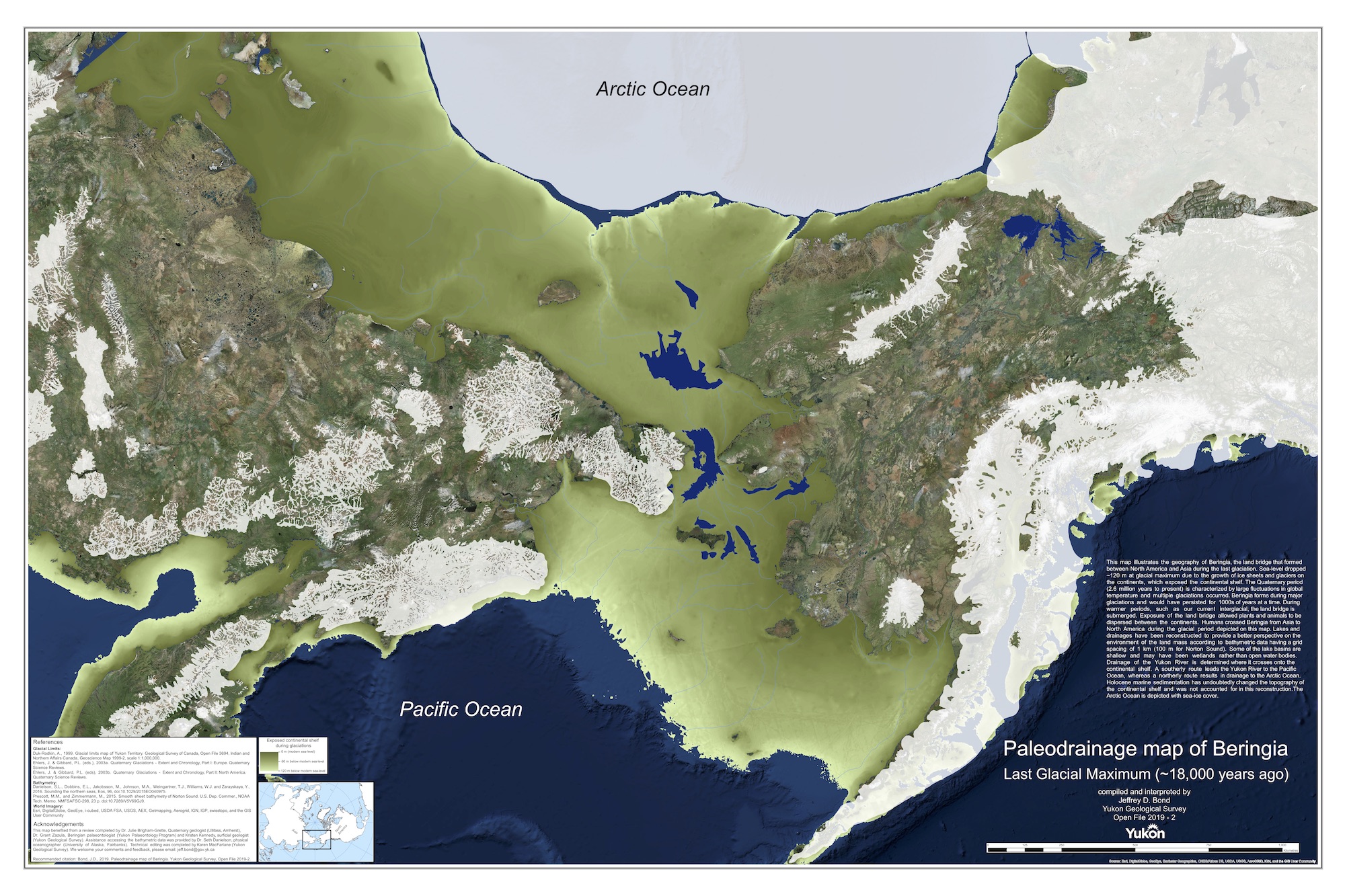
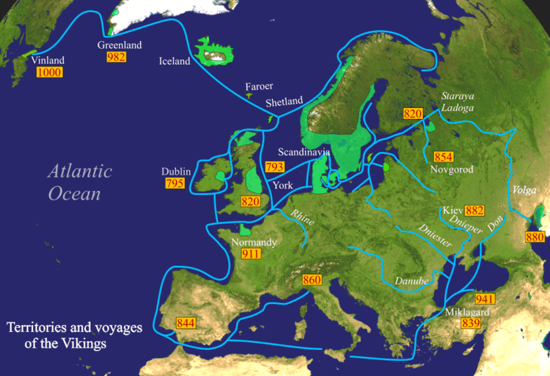
Comparing Viking and Berengian Refugia Cold Weather Environments, Diet and Genetic Adaptations -written by Grok


From Beringia to the Vikings: Ancient Journeys Through Ice and Adaptation

In the vast tapestry of human history, few stories captivate like those of populations who thrived in the planet's harshest cold environments. The Beringian standstill—a pivotal chapter in the peopling of the Americas—and the rise of the Vikings in Scandinavia offer fascinating parallels and contrasts. Both groups navigated extreme climates, evolving unique adaptations that shaped their genomes, bodies, and cultures. Yet, their paths diverged dramatically: one led to the Arctic indigenous peoples like the Inuit, while the other forged the Norse seafarers who raided and settled across Europe.

This article delves into the histories, daily lives, climatic challenges, and genomic legacies of these groups. Drawing from archaeological, genetic, and paleoclimatic evidence, we'll explore how isolation in icy refugia molded human resilience—and what echoes remain today. Note: While some popular notions link European haplogroups like H to Beringia, genetics tells a different story; Beringian migrants carried distinct lineages, highlighting separate evolutionary trajectories.

The Beringian Standstill: A Frozen Pause in Human Migration

Around 25,000 to 15,000 years ago, during the Last Glacial Maximum (LGM), a group of ancient Siberians became isolated on the now-submerged land bridge known as Beringia. This vast region, stretching from eastern Siberia to western Alaska, was an ice-free refugium amid global glaciation. The "standstill" hypothesis posits that these migrants were stranded for 2,400 to 9,000 years (not 11,000 as sometimes overstated), due to massive ice sheets blocking southward paths into the Americas.

Beringia wasn't a barren wasteland but a steppe-tundra ecosystem supporting megafauna like woolly mammoths, horses, and bison. Paleoecological records show a cold, arid landscape with sparse vegetation, high winds, and low precipitation—winters dipping to -20°C or lower, with brief summers around 4°C cooler than today. Humans here were hunter-gatherers, relying on big-game hunting, fishing, and gathering hardy plants. Tools like microblades and bone artifacts from sites like Swan Point in Alaska reveal sophisticated survival tech, including insulated clothing from animal hides.

This isolation fostered genetic divergence. Mitochondrial DNA haplogroups A, B, C, D, and X (particularly X2a) dominated, originating from East Asian founders—no trace of European-linked haplogroup H or its subclade H2a, which arose later in the Near East and Europe. Post-standstill, around 15,000 years ago, warming climates opened ice-free corridors, allowing migration into the Americas and the eventual emergence of diverse indigenous cultures, including the Thule ancestors of the Inuit.

Viking Origins: From Post-Glacial Pioneers to Norse Raiders

In contrast, Scandinavia's human history began as the LGM ice sheets retreated around 12,000–11,000 BCE. Early settlers were Mesolithic hunter-gatherers from southern European refugia (Western Hunter-Gatherers) and eastern Baltic regions (Eastern Hunter-Gatherers), arriving via land routes through modern Denmark and Germany. By 7,000 BCE, stable communities thrived, hunting reindeer and seals in a thawing landscape.

The Neolithic era (~4,000 BCE) brought Anatolian-derived farmers, introducing agriculture and mixing with locals. A major influx came around 2,800–2,000 BCE with Indo-European steppe herders (Yamnaya culture) from the Pontic-Caspian region, carrying R1a and R1b Y-chromosomes and Proto-Germanic languages. This genetic cocktail—~40-50% hunter-gatherer, 30-40% farmer, 20-30% steppe—formed the Nordic Bronze Age, evolving into Iron Age Germanic tribes.

The Viking Age (793–1066 CE) emerged from overpopulation, climatic shifts, and technological advances like longships. Vikings weren't a unified people but Norse farmers, traders, and warriors from Norway, Sweden, and Denmark, expanding to Iceland, Greenland, and beyond. Haplogroup H, peaking at 40-50% in Scandinavians, reflects this European heritage, with no Beringian ties.

Climate Showdown: Beringia's Extremes vs. Scandinavia's Temperate Edge

During the LGM, Beringia was a cold, dry steppe-tundra, with July temperatures ~4°C cooler and January ~2°C cooler than modern equivalents—overall harsher than habitable European zones. Scandinavia itself was largely ice-covered, forcing humans to southern refugia like Iberia, where winters were milder (4-8°C cooler) with more precipitation and diverse resources.

Post-LGM, Europe warmed rapidly, fostering forests and agriculture by 10,000 BCE. Beringia remained Arctic-like, with persistent cold driving adaptations in its descendants. Viking-era Scandinavia experienced the Medieval Warm Period (~900–1300 CE), aiding expansion, but winters were still brutal—sea ice trapped ships, and storms delayed voyages. Beringia's isolation amplified selection pressures, while Scandinavia's connectivity allowed cultural exchanges.

Daily Life: Survival in the Deep Freeze

Beringian life revolved around mobility: hunting megafauna with atlatls, fishing in icy rivers, and sheltering in semi-subterranean dwellings insulated with sod and bones. Diets were high in protein and fat from seals and caribou, with minimal carbs—essential for thermogenesis in -20°C winters.

Vikings, in a more temperate yet variable climate, farmed barley and rye in short summers, herded sheep and cattle, and fished cod. Winters meant indoor activities: storytelling, crafting, and feasting on preserved foods like butter-laden porridge. High-fat dairy and meat diets (35-40% fat) fueled them through dark months, with no evidence of widespread heart disease due to intense activity and short lifespans (30-40 years). Social adaptations included communal longhouses for warmth and Viking raids for resources during harsh years.

Genomic and Physical Adaptations: Evolving for the Cold

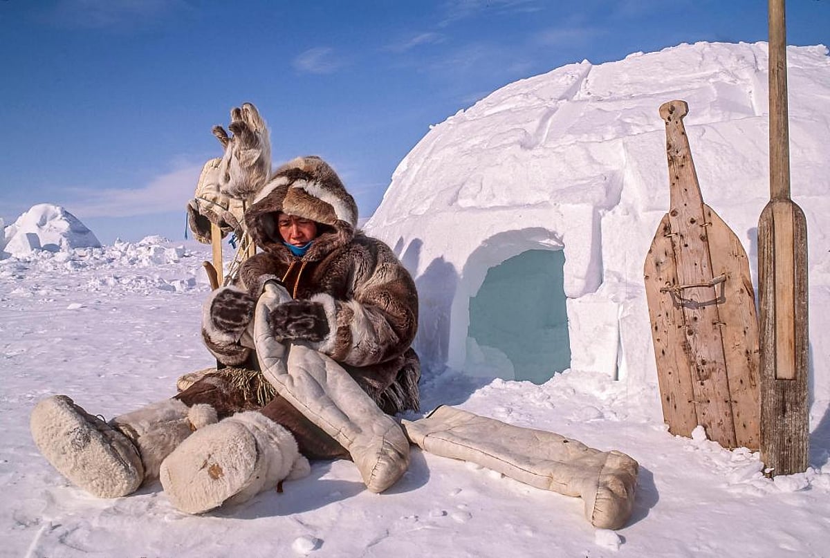
Beringian descendants, like the Inuit, exhibit profound cold adaptations per Bergmann's and Allen's rules: shorter limbs, broader chests/torsos to minimize heat loss, and flatter facial features (including potentially smaller breasts) to reduce frostbite risk. Visceral fat storage around organs provides insulation and energy, enabled by genes like CPT1A for efficient fat metabolism on marine diets rich in omega-3s. These mutations lower LDL cholesterol and insulin, aiding survival but raising modern risks like diabetes with Western diets.

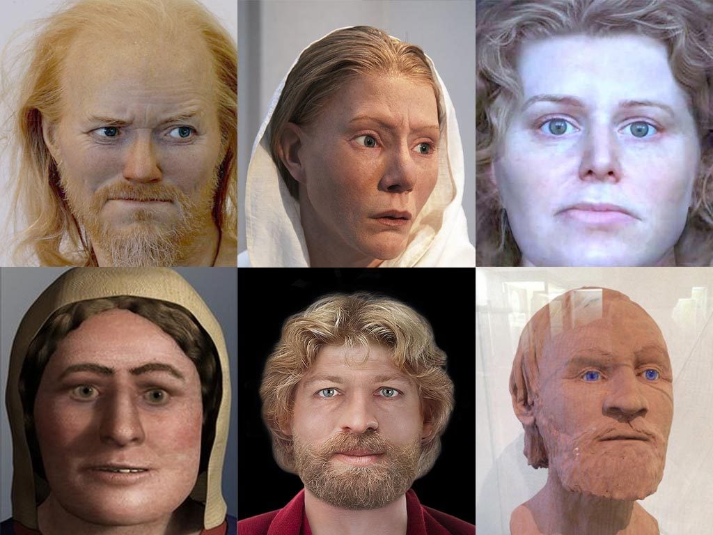
Scandinavians show milder adaptations: stockier builds and pale skin for vitamin D synthesis in low sun, but more external fat storage (e.g., in hips and breasts) due to calorie surpluses from farming. Haplogroup H may link to metabolic efficiency, but Vikings relied more on cultural tools—wool clothing, skis, and ships—than genetic extremes. Larger breasts in some European women tie to estrogen and nutrition, not cold selection.

Aftermath: Legacies in a Warming World

Beringian migrants populated the Americas, their adaptations persisting in Inuit genomes, now challenged by climate change—melting ice disrupts hunting, while dietary shifts amplify health issues. Vikings' expansions faded with the Little Ice Age (~1300 CE), but their genes influence modern Scandinavians, who face fewer cold extremes thanks to technology.

These stories remind us: Human adaptation is dynamic. As global warming reshapes the Arctic, understanding these ancient resiliences could inform future survival strategies.

What do you think—could Viking butter feasts or Inuit fat-metabolism genes inspire modern diets?

Canada May Become the First Western Hemisphere Vassal State of the EU

 The EU Chief Ursula von der Leyen is seeking to make Canada the first inferior member of the Eastern Hemispheric Euro-bloc. Canada, for mos...